Global Navigation Satellite Systems (GNSS/GPS)
A presentation by Damion Campbell - June 2018
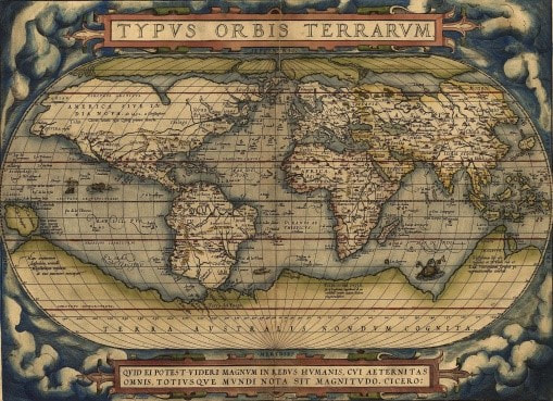
Since the early sixteenth century (and possibly even earlier) man has navigated the globe in order to map the continents and/or colonise territory. Thus, the first map of the earth showing the positions of the five major land masses was produced by Abraham Ortelius - a Belgian cartographer and geographer - in 1570. However, he erroneously identified the whole of the latitude in which Antarctica is located as “Terra Australis Non Dum Cognita”.
It was not until 1730 that the first sextant was manufactured and by 1764 the first chronometer (by which longitude could be determined accurately) came into use.
Today, satellites provide the technology by which accurate navigation of the earth can be achieved. There are several global navigation systems in existence: the American Navastar (known generally as GPS originally developed for the military), the Russian (GLONASS), the Indian (IRNSS) and the Chinese (BeiDou) which covers only the Far East. Gallileo, as a European Space Agency project, will add to these.
Probably the most well-known of the low-altitude satellites is the Hubble telescope at 420km. There are also polar-orbiting satellites, principally for search/rescue and maritime use. The satellites in geostationary orbit at 36,000 km provide communications capability and yet more communications satellites in the non-crowded zone at 20,000 km provide the 12 hour ground cover on which modern GPS systems rely.
Fixing a position on the earth’s surface requires a minimum of 4 satellites. Accurate measurement of time is essential for determining the interval between ‘pings’ from the satellites and this is achieved by using atomic (caesium) clocks. Various adjustments are made to the signals transmitted by the satellites to account for time accuracy and distortion due to the earth’s atmosphere. The accuracy of GPS can be within a few centimetres depending on receiving equipment. Most mobile phones are now GPS enabled and can offer navigational capability to within a few metres.
In view of the UK’s intention to withdraw from membership of the European Union (Brexit), the Government has now been excluded from further involvement in the Galileo project. Unfortunately, the huge cost of mounting a navigational satellite system of our own would be prohibitive. Thus, the future of satellite communication for the U.K. is uncertain.
After a short question and answer session, Colin thanked Damian for his fascinating presentation.
Janet Cato
June 2018